
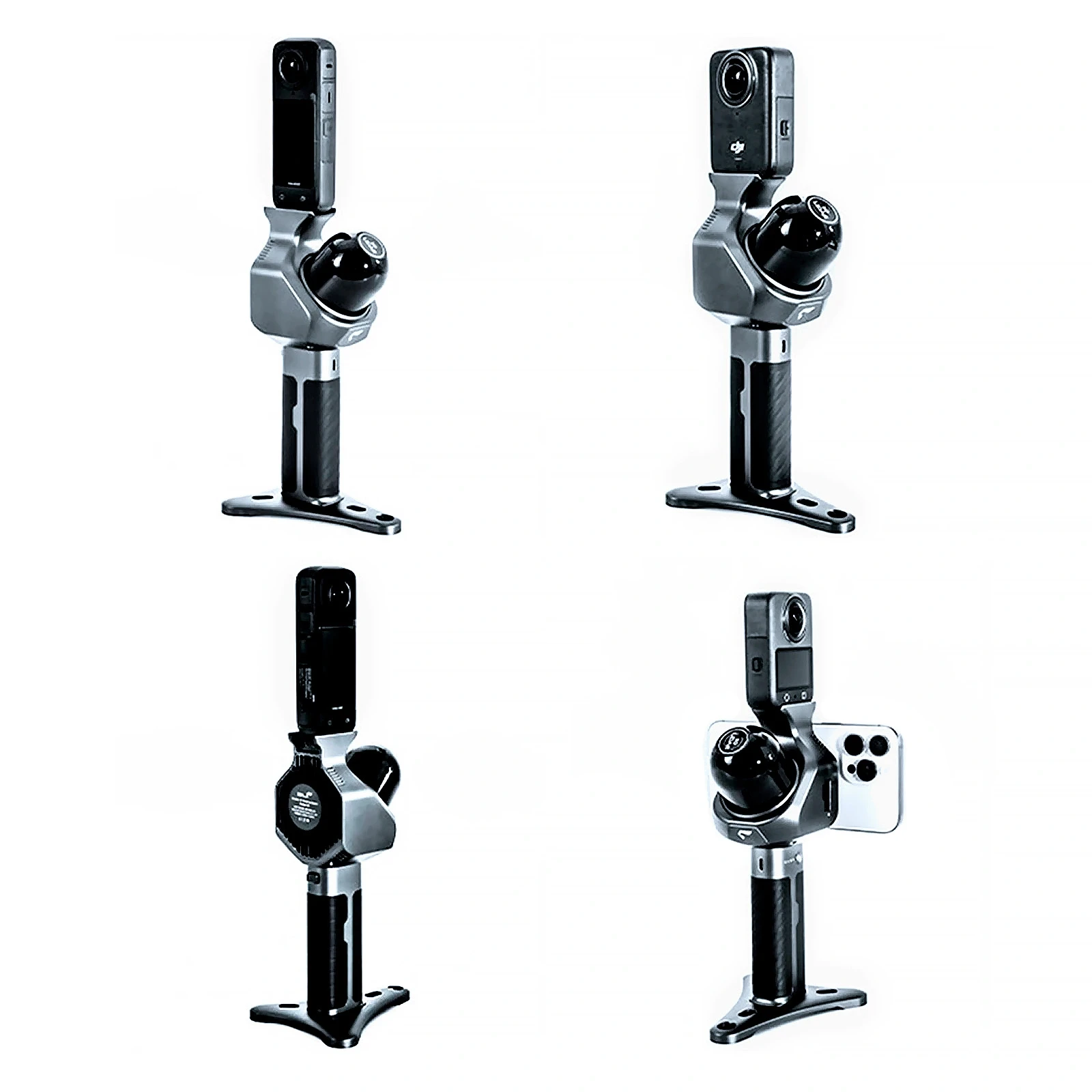
Topodrone has released Pocket 3D, a 700 gram handheld SLAM scanner that can reconstruct gaussian splatting from a consumer 360 camera.
Pocket 3D carries no panoramic camera of its own. A DJI Osmo 360 or an Insta360 X4, X4 Air or X5 fits the mount as supplied. The 16 channel LiDAR computes the trajectory and the true physical scale of the scene, and the 360 camera supplies texture. Topodrone released the unit, and the camera is purchased separately unless it comes in a bundle.
SLAM GO POST Pro, the desktop package included in the box, runs what Topodrone calls a hybrid 3DGS training architecture. The LiDAR point cloud serves as the primary spatial reference framework, and image based structure from motion works as a supplementary mechanism for selecting visual features. Topodrone attributes two results to that ordering, a more even distribution of Gaussians with fewer floating artifacts, and reconstruction that stays workable in weakly textured and poorly lit scenes.
The LiDAR spins through 360 degrees horizontally across a 40 degree vertical band at 10 Hz and returns 48,000 points per second. Ranging runs from 0.15 to 100 meters and falls to 30 meters against a target at 10 percent reflectivity. Topodrone rates relative accuracy at 2 cm and absolute accuracy at 5 cm, both at a range of 60 meters.
The unit measures 127 by 105 by 223 mm, draws 7 W, writes to a 32 GB TF card, and runs three hours at room temperature on a removable SP20 battery grip, rated from minus 20 to plus 50 Celsius.
SLAM GO POST Pro generates the point cloud, the pose aware panoramas and the 3DGS model at the press of a single button, and also merges data from multiple passes and carries measurement and annotation tools. Frames, their pose parameters and COLMAP data export to third party software, so a studio with its own training workflow can take the imagery and the LiDAR derived poses into that pipeline. Mesh and BIM models are built from Pocket 3D data in third party packages.
Pocket 3D carries no GNSS module, so the trajectory and the cloud are built in a local coordinate system, and georeferencing to a national or site system requires ground control points.
A heritage team already carrying an Insta360 X5 can walk a building once and come away with a measurable point cloud and a photorealistic splat of the same site. Pocket 3D is available now at $1,999.
This is about to be a exciting time for SLAM cameras as we move into the back half of the year.


