AirVis for Gaussian Splatting Reconstruction

Michael Rubloff

Michael Rubloff

AirVis Logo

There’s a new way to experience cloud based Gaussian Splatting on your phone and it’s called AirVis. Like many cloud reconstruction platforms, it lets you capture a short video and upload it to their processing pipeline. But unlike most, AirVis also allows you to download your original video afterward, a small but welcome touch for archiving and re-use.

It’s one of the first mobile apps to combine Apple’s Object Capture pipeline and the app is approachable for anyone curious about the technology that’s been defining the next generation of 3D reconstruction.

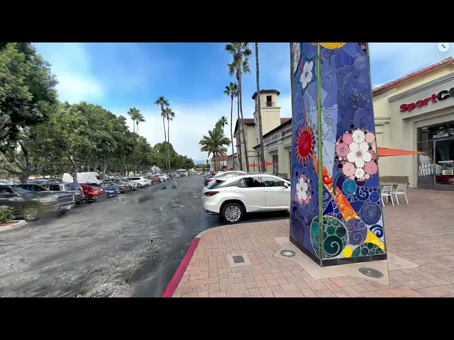
Once your capture has been uploaded and processed, you can view it directly in their built in viewer or, if you’re using an Apple device, step inside your own scan with Apple Vision Pro.

The app runs on iOS, macOS, and visionOS, and is also free to download. Capture and processing are available at no cost, with optional in app upgrades for longer uploads and advanced exports. The free plan supports up to 80 seconds of video, while the paid version ($19.99/month) extends that to 150 seconds and enables saving captures locally. The only current limitation is that existing videos can’t be uploaded from outside the app.

Recent updates have notably improved quality and performance, adding tile based rendering for stability on larger scenes, higher average splat counts, and skybox support for enhanced realism. macOS users can also upload existing scans for immersive viewing on Vision Pro, and all users have the option to make their files private.

You can get started with AirVis for free today on the iOS App Store or Google Play Store.

Featured

Recents

Platforms

Esri Brings 3D Analysis to Gaussian Splat Layers in ArcGIS Maps SDK for JavaScript 5.1

ArcGIS Maps SDK for JavaScript 5.1 adds 3D analysis; shadow, slice, line of sight, and elevation profiles to Gaussian splat layers, moving them toward parity with other 3D layers.

Michael Rubloff

Jun 29, 2026

Platforms

Esri Brings 3D Analysis to Gaussian Splat Layers in ArcGIS Maps SDK for JavaScript 5.1

ArcGIS Maps SDK for JavaScript 5.1 adds 3D analysis; shadow, slice, line of sight, and elevation profiles to Gaussian splat layers, moving them toward parity with other 3D layers.

Michael Rubloff

Platforms

GSOPs Brings Native Gaussian Splatting to TouchDesigner

GSOPs brings native Gaussian splatting to TouchDesigner, loading and rendering .ply/.spz splats through node operators with particle system and shader effects, in beta now.

Michael Rubloff

Jun 27, 2026

Platforms

GSOPs Brings Native Gaussian Splatting to TouchDesigner

GSOPs brings native Gaussian splatting to TouchDesigner, loading and rendering .ply/.spz splats through node operators with particle system and shader effects, in beta now.

Michael Rubloff

Platforms

SplatKing 1.1 Adds Single Camera Support

The free gaussian splatting app now works with many more iPhones.

Michael Rubloff

Jun 26, 2026

Platforms

SplatKing 1.1 Adds Single Camera Support

The free gaussian splatting app now works with many more iPhones.

Michael Rubloff

Platforms

COLMAP 4.1.0 Ships Caspar GPU Bundle Adjustment and Native 360 Reconstruction

COLMAP 4.1.0 adds Caspar, a GPU bundle adjustment backend up to two orders of magnitude faster than Ceres, plus native equirectangular SfM for 360 captures.

Michael Rubloff

Jun 26, 2026

Platforms

COLMAP 4.1.0 Ships Caspar GPU Bundle Adjustment and Native 360 Reconstruction

COLMAP 4.1.0 adds Caspar, a GPU bundle adjustment backend up to two orders of magnitude faster than Ceres, plus native equirectangular SfM for 360 captures.

Michael Rubloff

Trending Articles
  1. TRENDING
    Loading...
  2. TRENDING
    Loading...
  3. TRENDING
    Loading...
Michael Rubloff

Written by Michael Rubloff

Michael is the Founder and Managing Editor of Radiancefields.com

More from Michael Rubloff

More from Michael Rubloff

Platforms

Esri Brings 3D Analysis to Gaussian Splat Layers in ArcGIS Maps SDK for JavaScript 5.1

ArcGIS Maps SDK for JavaScript 5.1 adds 3D analysis; shadow, slice, line of sight, and elevation profiles to Gaussian splat layers, moving them toward parity with other 3D layers.

Michael Rubloff

Jun 29, 2026

Esri

Platforms

Esri Brings 3D Analysis to Gaussian Splat Layers in ArcGIS Maps SDK for JavaScript 5.1

Michael Rubloff

Jun 29, 2026

Esri

Platforms

Esri Brings 3D Analysis to Gaussian Splat Layers in ArcGIS Maps SDK for JavaScript 5.1

ArcGIS Maps SDK for JavaScript 5.1 adds 3D analysis; shadow, slice, line of sight, and elevation profiles to Gaussian splat layers, moving them toward parity with other 3D layers.

Michael Rubloff

Jun 29, 2026

Esri

Platforms

GSOPs Brings Native Gaussian Splatting to TouchDesigner

GSOPs brings native Gaussian splatting to TouchDesigner, loading and rendering .ply/.spz splats through node operators with particle system and shader effects, in beta now.

Michael Rubloff

Jun 27, 2026

GSOPs TouchDesginer

Platforms

GSOPs Brings Native Gaussian Splatting to TouchDesigner

Michael Rubloff

Jun 27, 2026

GSOPs TouchDesginer

Platforms

GSOPs Brings Native Gaussian Splatting to TouchDesigner

GSOPs brings native Gaussian splatting to TouchDesigner, loading and rendering .ply/.spz splats through node operators with particle system and shader effects, in beta now.

Michael Rubloff

Jun 27, 2026

GSOPs TouchDesginer

Platforms

SplatKing 1.1 Adds Single Camera Support

The free gaussian splatting app now works with many more iPhones.

Michael Rubloff

Jun 26, 2026

Gaussian SplatKing

Platforms

SplatKing 1.1 Adds Single Camera Support

Michael Rubloff

Jun 26, 2026

Gaussian SplatKing

Platforms

SplatKing 1.1 Adds Single Camera Support

The free gaussian splatting app now works with many more iPhones.

Michael Rubloff

Jun 26, 2026

Gaussian SplatKing