
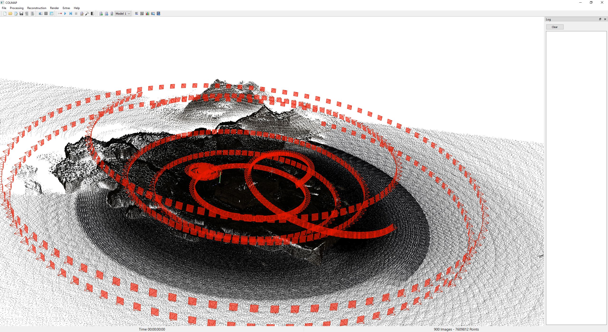
COLMAP 4.0 Introduces Major Performance and Infrastructure Updates

Michael Rubloff

Michael Rubloff

Tags

Email
Copy Link
Twitter
Linkedin
Reddit
Whatsapp
COLMAP

After years of steady evolution, COLMAP has released version 4.0, delivering one of the largest updates in the project’s history. The release introduces the global SfM pipeline through the integration of GLOMAP, expands support for modern learned features and matchers, improves bundle adjustment and image I/O performance, and adds new tools for working with meshes, large reconstructions, and Python driven workflows.

When GLOMAP was first introduced as a fast SfM method built on top of COLMAP, several researchers and radiance field hobbyists rejoiced. Today we are seeing the integration of GLOMAP directly into COLMAP as a alternative to the project’s long standing incremental and hierarchical mappers. Available through the new global mapper commands, the pipeline brings global SfM into the main COLMAP codebase and positions it as a core option for reconstruction rather than a separate companion project.

Version 4.0 also modernizes the front end of the reconstruction pipeline. The release adds ALIKED feature extraction through ONNX, along with LightGlue matching for both SIFT and ALIKED. The ability to read image orientation from EXIF metadata and automatically rotate images during feature extraction and matching has also been added.

On the geometry side, COLMAP 4.0 adds a structure-less image registration fallback based on a generalized relative pose estimator, allowing images to be registered even when they do not have the usual three view overlap. The release also adds new division camera models, a fisheye model without distortion parameters, optional support for position priors in absolute pose refinement, and guided geometric verification using a known reconstruction.

Bundle adjustment has been accelerated through a new single pose parameter block design and analytical Jacobians for the SIMPLE_RADIAL camera model, while image input has been significantly sped up by replacing FreeImage with OpenImageIO. PatchMatch Stereo now reads inputs in parallel, and the RANSAC loop has gained multi-threading support.

The release adds model clustering to break large reconstructions into more manageable sub-models, mesh simplification using quadric error metric decimation, and texture mapping for calibrated images. The GUI can now visualize textured meshes, import folders and PLY files through drag and drop, and handle mesh viewing with lower memory usage.

Python users also get a substantial upgrade. In addition to bindings for the feature extractor and matcher, COLMAP 4.0 adds Python bindings for depth and normal maps, improves incremental mapper and triangulator bindings, and exposes GPU custom pair matching through pycolmap.match_from_pairs.

COLMAP remains one of the most widely used foundations for camera pose estimation and scene initialization. A release that strengthens matching, calibration, reconstruction flexibility, and Python integration therefore has downstream effects across a large share of today’s radiance field pipelines.

The indispensable library remains open source with an BSD License and can be accessed here.

Featured

Recents

Platforms

Splatware Expands Its Gaussian Splatting Platform with New Training Models and 360° Workflows

Splatware introduces new Gaussian Splatting training models, expanded input support for images, video, 360° media, Insta360, Antigravity A1, COLMAP, and Radiance Field datasets.

Johannes Krüger

Aug 7, 2026

Platforms

Splatware Expands Its Gaussian Splatting Platform with New Training Models and 360° Workflows

Splatware introduces new Gaussian Splatting training models, expanded input support for images, video, 360° media, Insta360, Antigravity A1, COLMAP, and Radiance Field datasets.

Johannes Krüger

Esri Adds Georeferenced Gaussian Splat Layers to the ArcGIS Maps SDK for Unity at 2.4

Esri ArcGIS Maps SDK for Unity 2.4.0 adds a georeferenced Gaussian splat layer type for Unity scenes, on desktop only.

Michael Rubloff

Aug 7, 2026

Esri Adds Georeferenced Gaussian Splat Layers to the ArcGIS Maps SDK for Unity at 2.4

Esri ArcGIS Maps SDK for Unity 2.4.0 adds a georeferenced Gaussian splat layer type for Unity scenes, on desktop only.

Michael Rubloff

Platforms

XGRIDS Adds Real Time Lights and Shadows to Gaussian Splats in LCC Unity SDK 2.2.0

XGRIDS LCC Unity SDK 2.2.0 adds real-time point and spot lights with shadow casting to Gaussian splat scenes, gains Ubuntu support, and improves XR rendering.

Michael Rubloff

Aug 6, 2026

Platforms

XGRIDS Adds Real Time Lights and Shadows to Gaussian Splats in LCC Unity SDK 2.2.0

XGRIDS LCC Unity SDK 2.2.0 adds real-time point and spot lights with shadow casting to Gaussian splat scenes, gains Ubuntu support, and improves XR rendering.

Michael Rubloff

Esri Adds Gaussian Splat Layers to the ArcGIS Maps SDKs for Native Apps at 300.1

Esri ArcGIS Maps SDKs for Native Apps 300.1 adds Gaussian splat layers to .NET and Qt desktop apps, reading web layers or local 3D Tiles for offline use.

Michael Rubloff

Aug 6, 2026

Esri Adds Gaussian Splat Layers to the ArcGIS Maps SDKs for Native Apps at 300.1

Esri ArcGIS Maps SDKs for Native Apps 300.1 adds Gaussian splat layers to .NET and Qt desktop apps, reading web layers or local 3D Tiles for offline use.

Michael Rubloff

Trending Articles
  1. TRENDING
    Loading...
  2. TRENDING
    Loading...
  3. TRENDING
    Loading...
Michael Rubloff

Written by Michael Rubloff

Michael is the Founder and Managing Editor of Radiancefields.com

Email
Copy Link
Twitter
Linkedin
Reddit
Whatsapp

More from Michael Rubloff

More from Michael Rubloff

Esri Adds Georeferenced Gaussian Splat Layers to the ArcGIS Maps SDK for Unity at 2.4

Esri ArcGIS Maps SDK for Unity 2.4.0 adds a georeferenced Gaussian splat layer type for Unity scenes, on desktop only.

Michael Rubloff

Aug 7, 2026

Esri Adds Georeferenced Gaussian Splat Layers to the ArcGIS Maps SDK for Unity at 2.4

Michael Rubloff

Aug 7, 2026

Esri Adds Georeferenced Gaussian Splat Layers to the ArcGIS Maps SDK for Unity at 2.4

Esri ArcGIS Maps SDK for Unity 2.4.0 adds a georeferenced Gaussian splat layer type for Unity scenes, on desktop only.

Michael Rubloff

Aug 7, 2026

Platforms

XGRIDS Adds Real Time Lights and Shadows to Gaussian Splats in LCC Unity SDK 2.2.0

XGRIDS LCC Unity SDK 2.2.0 adds real-time point and spot lights with shadow casting to Gaussian splat scenes, gains Ubuntu support, and improves XR rendering.

Michael Rubloff

Aug 6, 2026

XGRIDS

Platforms

XGRIDS Adds Real Time Lights and Shadows to Gaussian Splats in LCC Unity SDK 2.2.0

Michael Rubloff

Aug 6, 2026

XGRIDS

Platforms

XGRIDS Adds Real Time Lights and Shadows to Gaussian Splats in LCC Unity SDK 2.2.0

XGRIDS LCC Unity SDK 2.2.0 adds real-time point and spot lights with shadow casting to Gaussian splat scenes, gains Ubuntu support, and improves XR rendering.

Michael Rubloff

Aug 6, 2026

XGRIDS

Esri Adds Gaussian Splat Layers to the ArcGIS Maps SDKs for Native Apps at 300.1

Esri ArcGIS Maps SDKs for Native Apps 300.1 adds Gaussian splat layers to .NET and Qt desktop apps, reading web layers or local 3D Tiles for offline use.

Michael Rubloff

Aug 6, 2026

Esri

Esri Adds Gaussian Splat Layers to the ArcGIS Maps SDKs for Native Apps at 300.1

Michael Rubloff

Aug 6, 2026

Esri

Esri Adds Gaussian Splat Layers to the ArcGIS Maps SDKs for Native Apps at 300.1

Esri ArcGIS Maps SDKs for Native Apps 300.1 adds Gaussian splat layers to .NET and Qt desktop apps, reading web layers or local 3D Tiles for offline use.

Michael Rubloff

Aug 6, 2026

Esri