Tag
ArcGIS
3 articles
News
Clemson Turns Existing Drone Imagery Into a Stadium Splat
Clemson University reprocessed existing drone imagery of Memorial Stadium into a Gaussian splat and a mesh in Esri ArcGIS Drone2Map in about 13 hours total.
Michael Rubloff
Oct 17, 2026

News
Clemson Turns Existing Drone Imagery Into a Stadium Splat
Clemson University reprocessed existing drone imagery of Memorial Stadium into a Gaussian splat and a mesh in Esri ArcGIS Drone2Map in about 13 hours total.
Michael Rubloff
News
Clemson Turns Existing Drone Imagery Into a Stadium Splat
Clemson University reprocessed existing drone imagery of Memorial Stadium into a Gaussian splat and a mesh in Esri ArcGIS Drone2Map in about 13 hours total.
Michael Rubloff
Oct 17, 2026
News
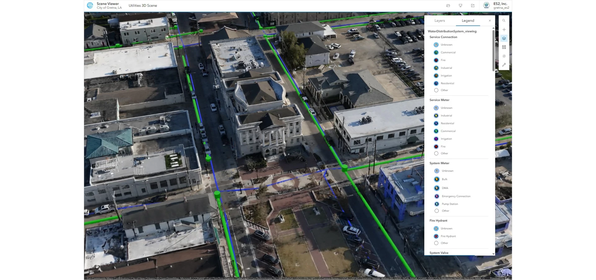
Gretna, Louisiana Splats the Whole City
Gretna, Louisiana had ES2 fly its four square miles with a WingtraRAY drone for imagery and lidar, processed into Gaussian splats in Esri ArcGIS Reality.
Michael Rubloff
Oct 16, 2026
News
Gretna, Louisiana Splats the Whole City
Gretna, Louisiana had ES2 fly its four square miles with a WingtraRAY drone for imagery and lidar, processed into Gaussian splats in Esri ArcGIS Reality.
Michael Rubloff
News
Gretna, Louisiana Splats the Whole City
Gretna, Louisiana had ES2 fly its four square miles with a WingtraRAY drone for imagery and lidar, processed into Gaussian splats in Esri ArcGIS Reality.
Michael Rubloff
Oct 16, 2026
Platforms
ArcGIS Earth 3.0 Adds Gaussian Splat Layers
ArcGIS Earth 3.0 adds georeferenced Gaussian splat layers to the free desktop globe app, shown in new local scenes beside basemaps, terrain and scene layers.
Michael Rubloff
Oct 2, 2026

Platforms
ArcGIS Earth 3.0 Adds Gaussian Splat Layers
ArcGIS Earth 3.0 adds georeferenced Gaussian splat layers to the free desktop globe app, shown in new local scenes beside basemaps, terrain and scene layers.
Michael Rubloff
Platforms
ArcGIS Earth 3.0 Adds Gaussian Splat Layers
ArcGIS Earth 3.0 adds georeferenced Gaussian splat layers to the free desktop globe app, shown in new local scenes beside basemaps, terrain and scene layers.
Michael Rubloff
Oct 2, 2026
Platforms
Esri Adds Gaussian Splat Layers to the ArcGIS Maps SDK for Unity 2.4.0
ArcGIS Maps SDK for Unity 2.4.0 adds a georeferenced Gaussian splat layer that reads 3D Tiles, and ships with no identify, no filtering, and no mesh collider.
Michael Rubloff
Sep 16, 2026

Platforms
Esri Adds Gaussian Splat Layers to the ArcGIS Maps SDK for Unity 2.4.0
ArcGIS Maps SDK for Unity 2.4.0 adds a georeferenced Gaussian splat layer that reads 3D Tiles, and ships with no identify, no filtering, and no mesh collider.
Michael Rubloff
Platforms
Esri Adds Gaussian Splat Layers to the ArcGIS Maps SDK for Unity 2.4.0
ArcGIS Maps SDK for Unity 2.4.0 adds a georeferenced Gaussian splat layer that reads 3D Tiles, and ships with no identify, no filtering, and no mesh collider.
Michael Rubloff
Sep 16, 2026
Load More