
Cintoo has announced 360 Edition, a new solution that converts 360 degree video walkthroughs into navigable 3D data, extending how panoramic capture can be used inside professional reality capture workflows.
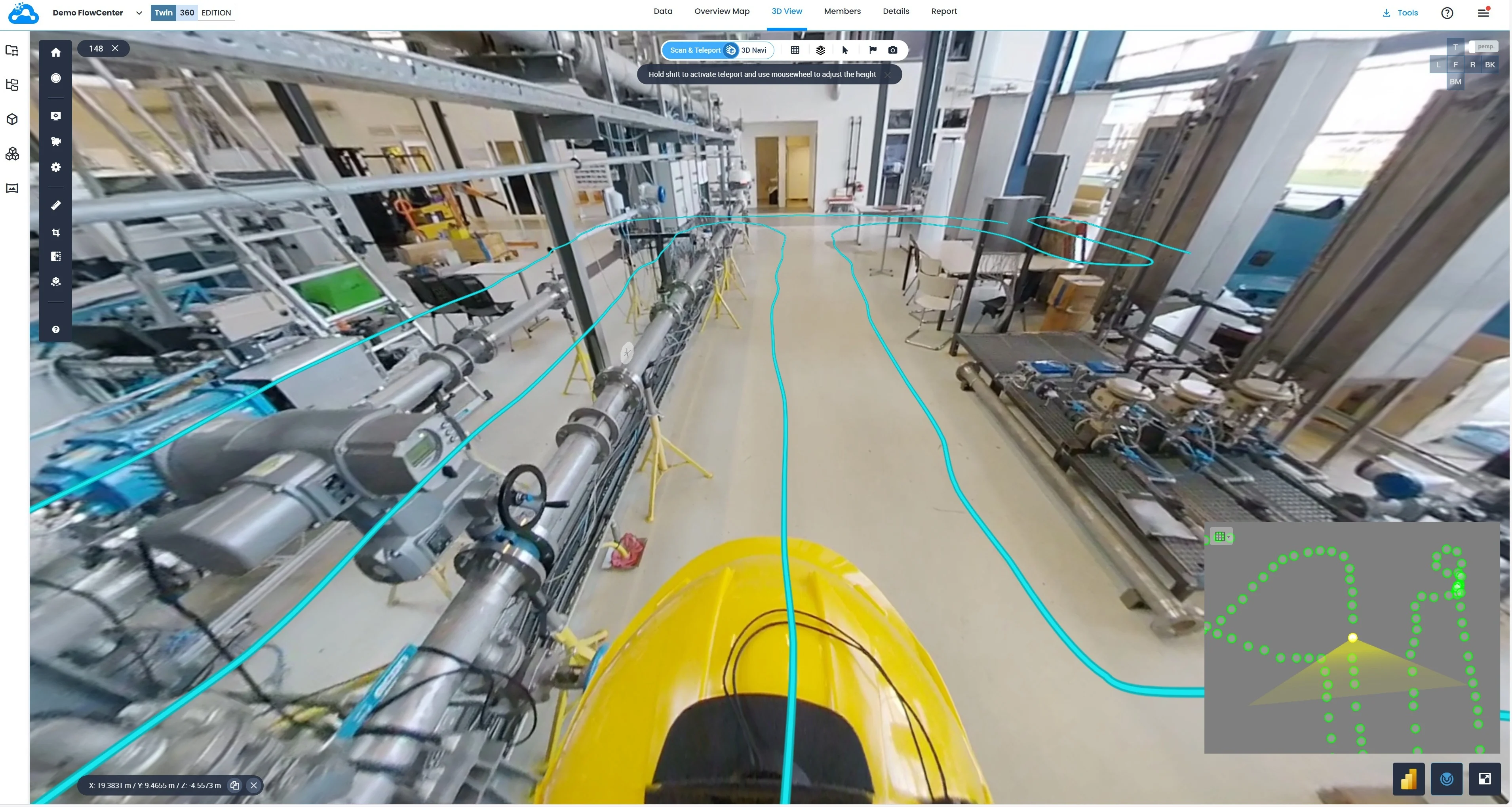
The release enables Ricoh 360 imagery to be processed, aligned, and visualized alongside terrestrial laser scans and BIM or CAD models within a single synchronized 3D environment. Because of the partnership this is exclusive to Ricoh cameras and will not work with DJI’s Osmo 360 or Insta360’s X5.
For the radiance fields community, the most notable addition is support for Gaussian Splats visualization. Panoramic imagery and 3D datasets can now be rendered together using an in house developed splat pipeline, allowing dense visual information from lightweight 360 captures to integrate more naturally with scan derived geometry.
Cintoo’s 360 Edition includes automatic camera path processing, manual 3D alignment tools, and access to existing features such as annotations, crops, and measurements. The workflow is designed around an automated field to cloud pipeline intended to reduce manual processing and accelerate time to visualization.
The beginning of 2026 has quickly seen a growing number of platforms and excitement surrounding the world of 360 capture. I am reporting here from Geo Week where gaussian splatting has been dominating conversations.
Learn more about Cintoo’s 360 Edition here.


New to Gaussian Splatting? Start here


